52 Hike Challenge ***Complete!***

BorregoWrangler

Adventurist
Founding Member
52Hikes.jpeg


"Challenging you to join us & others around the world, to hike at least once per week for 52 weeks! Hashtag photos #52hikechallenge to be featured."

http://www.52hikechallenge.com/

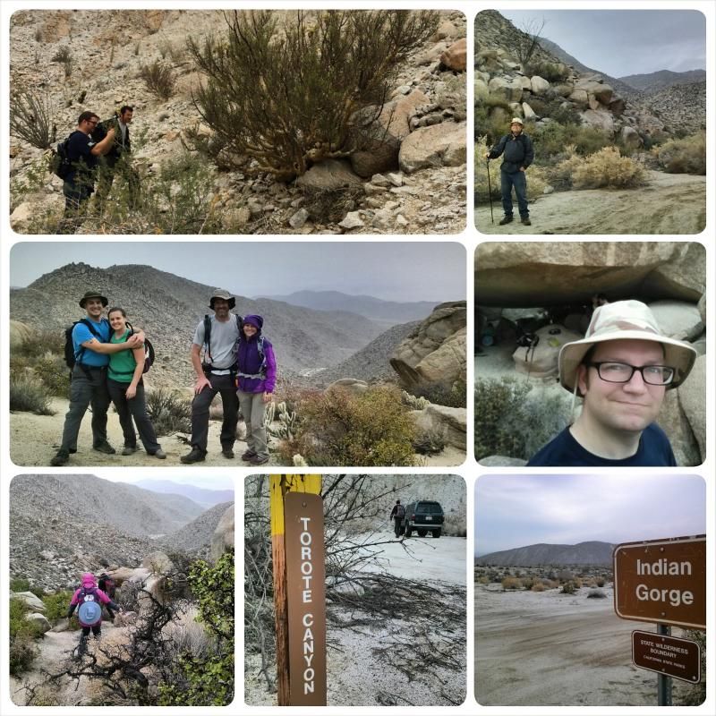
I guess you could call this a "new year's resolution." I came across this while researching trails in my area and figured it would go hand-in-hand with my goals to hike more and to get into better shape. As I complete these hikes I'll post updates here. Ya'll can keep me accountable! :)

The outdoor travel and outfitters store, Adventure 16 has a similar deal going on where you can pick up a free "kit" of 52 hikes for either San Diego or Los Angeles Counties. Info for that here: http://positive.adventure16.com/c/a...-Week-in-a-Jar-FREE-Do-It-Yourself-Kit-153835
 
Hike #1 Complete! :D 
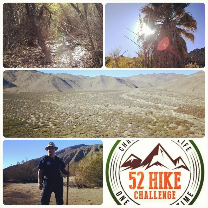
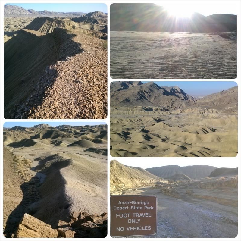
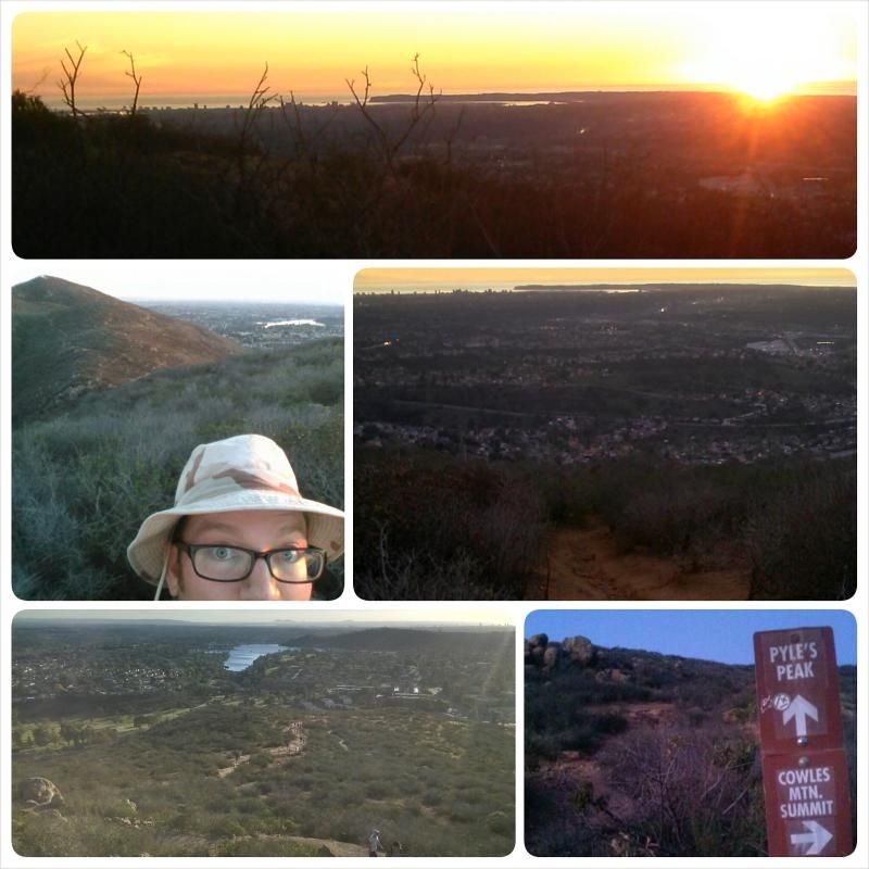
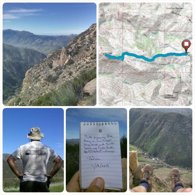
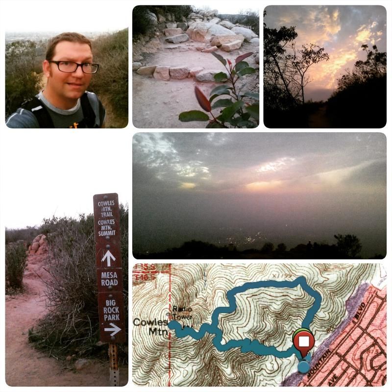
Getting an early start on it.

MIDDLE WILLOWS UPPER COYOTE CANYON HIKE | ANZA BORREGO-DESERT STATE PARK

Distance: 6 miles
Elevation Gain/Loss: 500'/500'
Date: 12-26-2014

IMG_20141226_155907_zpsbmrfmho6.jpg
 
Hike #2... Maybe a moderator can move this thread to the hiking section? :redface

MUD HILLS WASH to ELEPHANT KNEES | ANZA-BORREGO DESERT STATE PARK

Distance: 5 miles
Elevation Gain/Loss: 675'/675'
Date: 01-01-2015

PhotoGrid_1420165387152_zpszr4eog2f.jpg
 
Very nice John! I'm hoping the weather is a whole lot more conducive to hiking this year so we too can get a lot more trail under our boots this year.

Maybe a moderator can move this thread to the hiking section?

Done.
 
Hike #3... bagging two peaks!

COWLES MOUNTAIN & PYLES PEAK | MISSION TRAILS REGIONAL PARK, SAN DIEGO

Distance: 5.2 miles
Elevation Gain/Loss: 2000'/2000'
Date: 01-06-2015

IMG_20150106_202622_zpsqrkhzx6j.jpg


This long and tiring out-and-back trek has some fun and twisty trails. But first, I had to climb Cowles Mountain; at 1591 feet, its the the highest elevation within the city limits of San Diego. (Pyles is 1,379 ft) There must have been hundreds of people on the trail to Cowles Mountain summit. I'm sure the New Year's resolution crowd will thin out soon. But once I started off toward Pyles Peak, I must have left about 99 percent of the hiker traffic behind; passing only four other people. The views are serene and filled with the green colors of the Chapparal brush dotting the surrounding mountainside, something you won't experience climbing up the dried-out and relatively bland-looking trails of Cowles. Pyles in contrast has the special feel of a path less traveled. Just the way I like it.

52 Hike Challenge Stats

Total Distance: 16.2 miles
Total Elevation Gain/Loss: 3175'/3175'
 
If anyone is interested in an eight mile round trip hike through history and a true Garden of Eden - The Big Santa Anita Canyon above Arcadia, then this is an incredible hike. This Canyon is where I do my "Day Job" I hike into the Canyon every day to work on and restore the historic cabins there. I have participated in and cooked for many weekend parties at the extremely historic Sturtevant Camp (mentioned below). It's like getting into a time machine and setting the clock back 100 years!

Here is some info on an organized hike into the Canyon with folks that have an intimate knowledge of its rich history:

Cam


Below is an article that will appear in Modern Hiker tomorrow (www.modernhiker.com) concerning our Hike into History – Sturtevant Camp scheduled for January 25, 2015. I am thrilled that Casey, from Modern Hiker, will be co-leading the hike. Please join us. If you have not been to Sturtevant Camp, it will be great way to take a look at this gem from the Canyon. The hike will also help you to understand why it is important to save this wonderful place from the past and, now, the future. If you can, please rsvp so we have an idea how many people are coming.

In 2015, Modern Hiker is very excited to announce a revival of our Go Hike L.A. project - a series of group hikes to some of our favorite places in the Los Angeles region.
We are hoping to make this a monthly event, and the first on the list for 2015 is a trek to historic Sturtevant Camp in Santa Anita Canyon.
Sturtevant was the first wilderness resort of the Golden Age of Hiking - and is the only one that remains. Currently run by the Methodist Church, the good folks at Adams Pack Station are raising funds to purchase the property and make it more accessible to campers (currently reservation times are very limited) as well as to hold themed events at the camp like Board Game Days and live concerts.
On Sunday, January 25th, Modern Hiker will co-lead a hike with Deb Burgess of Adams Pack Station. We will travel with the mule train into Camp Sturtevant, where we'll be able to peek into all of the buildings on site - including the oldest existing U.S. Forest Service structure still in its original location - a beautiful hand-built cabin (circa 1903) that served as the first ranger station - and the original 1897 Swiss Dining Pavilion, which currently serves as Sturtevant Lodge.
Along the way, we'll learn about the rich and fascinating history of Santa Anita Canyon and the Camp itself - and we'll have some light lunches brought in via mule train!
Meet at the Pack Station at 7:30AM. Park at Chantry Flats or along the road with an Adventure Pass, or use one of the private parking spaces at Adams Pack Station for $10. The cost of the hike is free and light lunches and water will be provided, but bring your own food and water if you're a big eater or thirsty hiker. This is a fairly moderate hike but you'll put some miles on your boots, so be in good hiking condition. The hike will be done at your own risk.
After the hike, you can stay with the group to return to Chantry Flats or go off on your own to Mount Zion (or do a great butt-kicker up to Mount Wilson). Come learn some amazing history, meet some fellow hikers, and have a great Sunday hike!
 
I get enough exercise as it is....just did a full moon hike. 4 miles, snow and ice, 28 degrees F, 1100 foot elevation gain. Bear Mountain , did it in my shirt sleeves, mostly with out head light. Search and Rescue.
 

Attachments

  • Bear Mtn_.jpg
    Bear Mtn_.jpg
    1.1 MB · Views: 79
Hike #4

SOLSTICE CAVE & TOROTE CANYON | ANZA BORREGO-DESERT STATE PARK

Distance: 4 miles
Elevation Gain/Loss: 1444'/1444'
Date: 01-11-2015

IMG_20150111_181836_zpsune3hrxf.jpg


Hike 4 of my 52 Hike Challenge was to the Solstice Cave in Indian Valley and Torote Canyon. You can't find any specific information on the cave online or in any guidebook. The lack of info helps protect this special archaeological site. Torote Canyon, a tributary of Indian Gorge, shelters dozens of rare elephant trees. For many years it was thought not to exist at all in the US, until it's discovery in 1937.

Total distance: 20.2 miles
Total elevation gain/loss: 4619'/4619'
 
Another great hike and trip report John! And thanks for helping us to reach our goal for our 12 hike challenge, 12 hikes in 12 months :D
 
Hike #5

EAGLE PEAK | CLEVELAND NATIONAL FOREST

Distance: 4.75 miles
Elevation Gain/Loss: 1300'/1300'
Date: 01-18-2015

PhotoGrid_1421623589841_zpsensqqi4f.jpg


Standing tall amid lesser bumps on the west slope of the Cuyamaca Mountains, Eagle Peak has a view of the island-dimpled Pacific Ocean, parts of urban and suburban San Diego, and the higher mountains to the east. Hawks and golden eagles can sometimes be seen soaring on updrafts overhead.
 
Hike #6

COWLES MOUNTAIN via BARKER WAY & MESA TRAIL | MISSION TRAILS REGIONAL PARK, SAN DIEGO

Distance: 3.2 miles
Elevation Gain/Loss: 1722'/1768'
Date: 01-20-2015

IMG_20150120_181054_zpszzbmcxdl.jpg


As both the highest peak in San Diego and one of the most popular hiking destinations in the county, Cowles Mountain is better known for spectacular views of Southern California than quiet, wilderness solitude. Indeed, the popular southern route that begins near the corner of Navajo Road and Golfcrest Drive accommodates at least several hundred hikers daily. But start your hike just a little more than a mile to the east, and you can have the same superb hiking and sweeping vistas that make Cowles so popular with a fraction of the south-route crowds, not to mention an easier time finding a parking spot.
 
Back
Top Bottom