
You are using an out of date browser. It may not display this or other websites correctly.
You should upgrade or use an alternative browser.
You should upgrade or use an alternative browser.
2016 Adventure Series 52 Hike Challenge
- Thread starter BorregoWrangler
- Start date
Glad to see you are doing this John! I really loved following along last year.. I always tell myself I am going to start hiking but never get around to it.
Thanks. Hopefully you can start hiking yourself. There are just so many benefits! I didn't think I had the time for it either, but it's like anything else in life that you want to do or change; it starts with a thought, followed by a step.
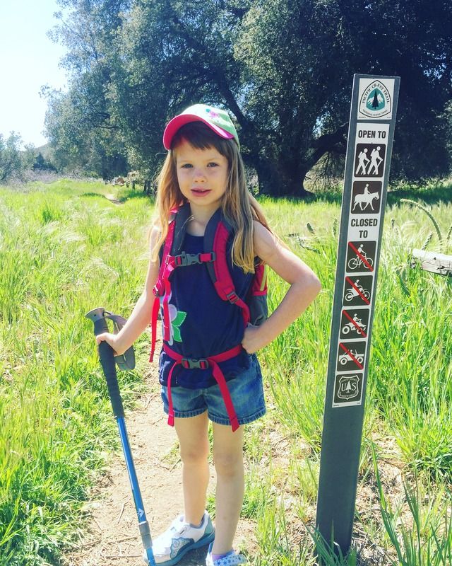
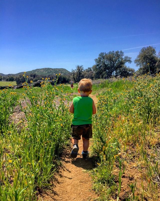
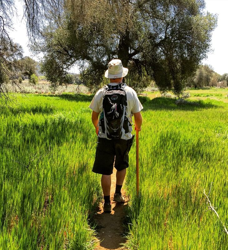
#14 Lightning Ridge Trail
2 miles | +240'
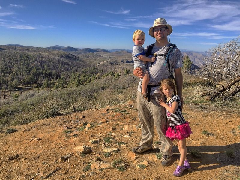
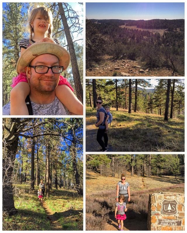
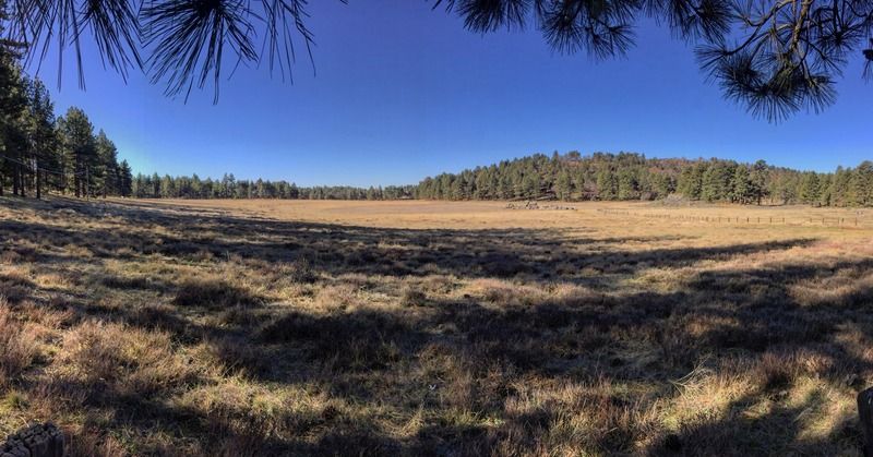
For a quick reconnaissance of the Laguna Mountain Recreation Area, and to discover a somewhat hidden vista point, try hiking the Lightning Ridge Trail overlooking Laguna Campground. This goes to Chula Vista Reservoir, a water tank on top of a hill. The panoramic view from the reservoir includes Little Laguna Lake and a long stretch of Laguna Meadow. It was an easy trail close to camp that the whole family could enjoy.
2 miles | +240'
For a quick reconnaissance of the Laguna Mountain Recreation Area, and to discover a somewhat hidden vista point, try hiking the Lightning Ridge Trail overlooking Laguna Campground. This goes to Chula Vista Reservoir, a water tank on top of a hill. The panoramic view from the reservoir includes Little Laguna Lake and a long stretch of Laguna Meadow. It was an easy trail close to camp that the whole family could enjoy.
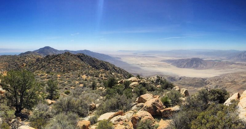
#15 Foster Point
1.5 miles | +100'
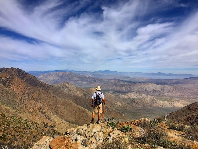
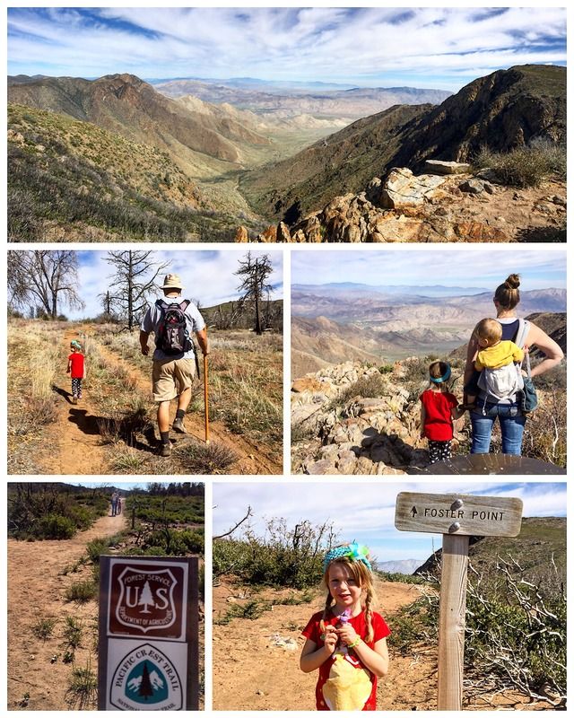
One of the best views to be found along the Pacific Crest Trail in San Diego is at Foster Point. At 5,730 feet elevation, this viewpoint has sweeping three-hundred and sixty degree views year round of the Anza-Borrego Desert, and the Cleveland National Forest. You also have the opportunity to identify many of Southern California’s highest mountains here. A directional finder, installed by the Sierra Club, helps you to pinpoint 17 different peaks in the distance. It was an easy and enjoyable trek for the wife and kids.
1.5 miles | +100'
One of the best views to be found along the Pacific Crest Trail in San Diego is at Foster Point. At 5,730 feet elevation, this viewpoint has sweeping three-hundred and sixty degree views year round of the Anza-Borrego Desert, and the Cleveland National Forest. You also have the opportunity to identify many of Southern California’s highest mountains here. A directional finder, installed by the Sierra Club, helps you to pinpoint 17 different peaks in the distance. It was an easy and enjoyable trek for the wife and kids.
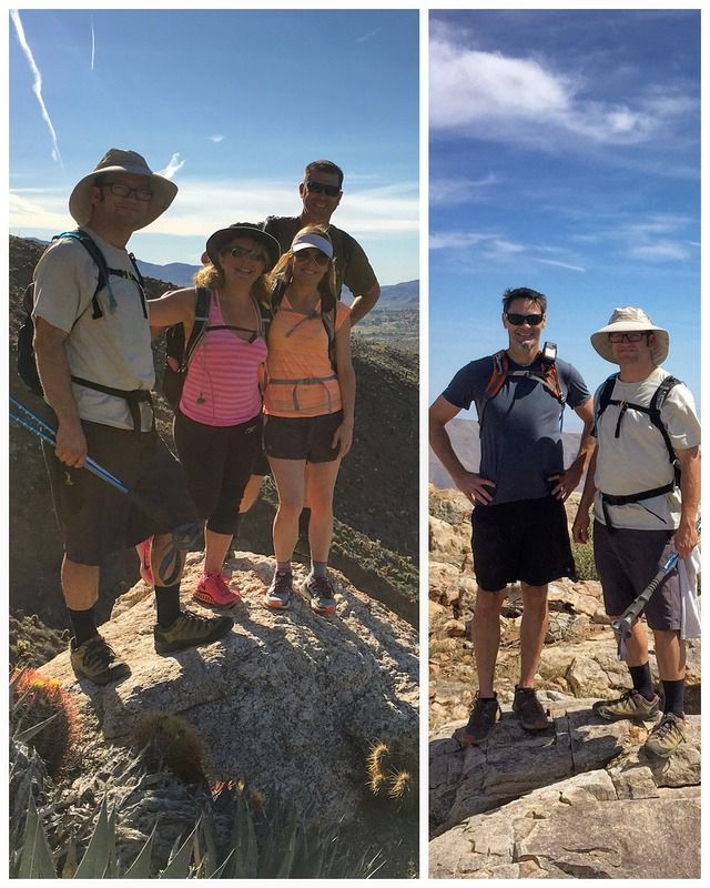
#16 PCT Southern Terminus to Hwy 94
6.25 miles | +600'
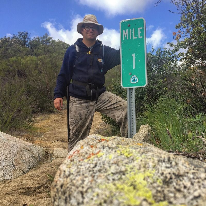
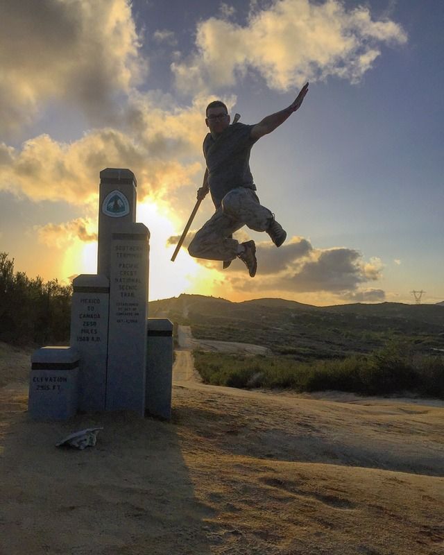
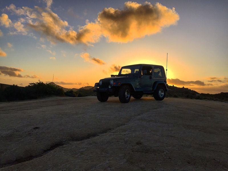
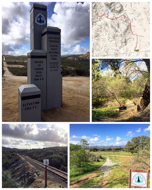
I came out to check out the new monument at the PCT Southern Terminus and hike a little ways past Highway 94 to the railroad tracks.
It was a sight not seen in almost 30 years. For three hours on January 9th 2016, there was no monument marking the southern end of the PCT on the desert rise south of Campo. The familiar silhouette made by five fir pillars was gone.
In a long-planned and well-choreographed action, PCTA volunteers erected the trail’s new southern terminus monument. The old one had been showing its age. Campo weather, including harsh summer sun and winter rain and snow, had changed the foot-thick wooden posts into cavity-ridden teeth. There were deep cracks and pervasive wood rot. Once as rigid as stone monoliths, two of the posts could be rocked back and forth by hand.
Originally erected in 1988, the monument and its northern twin were built to commemorate the 20th anniversary of the National Trails System Act. That act designated the first two national scenic trails, the PCT and its eastern cousin, the Appalachian Trail.
6.25 miles | +600'
I came out to check out the new monument at the PCT Southern Terminus and hike a little ways past Highway 94 to the railroad tracks.
It was a sight not seen in almost 30 years. For three hours on January 9th 2016, there was no monument marking the southern end of the PCT on the desert rise south of Campo. The familiar silhouette made by five fir pillars was gone.
In a long-planned and well-choreographed action, PCTA volunteers erected the trail’s new southern terminus monument. The old one had been showing its age. Campo weather, including harsh summer sun and winter rain and snow, had changed the foot-thick wooden posts into cavity-ridden teeth. There were deep cracks and pervasive wood rot. Once as rigid as stone monoliths, two of the posts could be rocked back and forth by hand.
Originally erected in 1988, the monument and its northern twin were built to commemorate the 20th anniversary of the National Trails System Act. That act designated the first two national scenic trails, the PCT and its eastern cousin, the Appalachian Trail.
Last edited:
#17 Oakzanita Peak
4.5 miles | +1200'
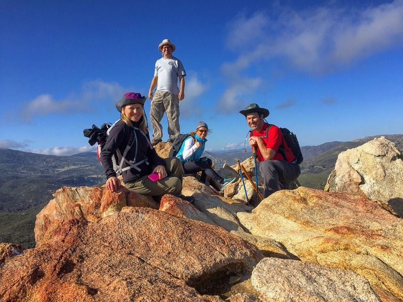
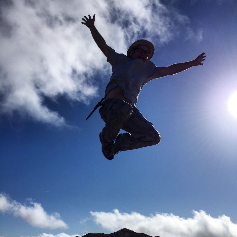
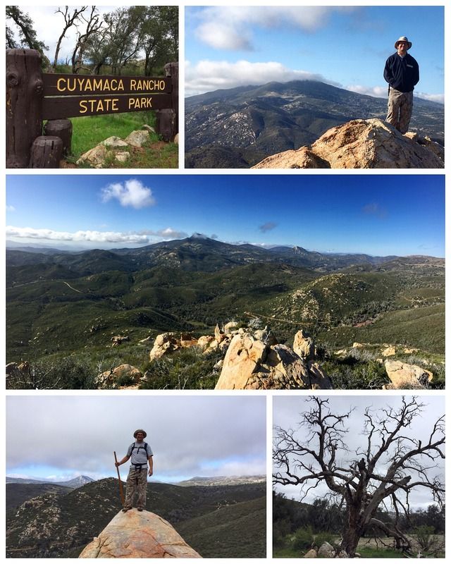
Oakzanita Peak is one of only a handful of named peaks in the Cuyamaca Mountains, yet its humble appearance -- at least on approach -- wouldn't inspire most hikers to climb it. Actually, the view from its rocky summit is quite impressive on a clear day, and well worth the hike.
The name "Oakzanita" was derived from the oaks and manzanita growths of the mountain slope. The view includes most of the Cuyamacas' southern reaches: Pine, Airplane, and Arrowmakers ridges to the northwest, and the meadows of East Mesa to the northeast. In the distance lie the dark, wave-shaped form of Cuyamaca Peak and the pointed, alabaster summit of Stonewall Peak.
4.5 miles | +1200'
Oakzanita Peak is one of only a handful of named peaks in the Cuyamaca Mountains, yet its humble appearance -- at least on approach -- wouldn't inspire most hikers to climb it. Actually, the view from its rocky summit is quite impressive on a clear day, and well worth the hike.
The name "Oakzanita" was derived from the oaks and manzanita growths of the mountain slope. The view includes most of the Cuyamacas' southern reaches: Pine, Airplane, and Arrowmakers ridges to the northwest, and the meadows of East Mesa to the northeast. In the distance lie the dark, wave-shaped form of Cuyamaca Peak and the pointed, alabaster summit of Stonewall Peak.

Thanks!
We'll have to go camping at LCIR one of these weekends. The old fire tower is on top of the highest peak in San Diego County.
I love the sound of that. It's been a while since I've been out there.
#18 Rock Climber's Loop - MTRP
1 mile | +400'
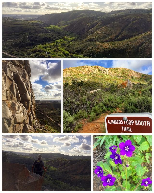
Late-spring afternoons and early evenings in San Diego are often perfect for a bit of exercise after work or before an evening meal. Close and convenient Mission Trails Regional Park offers a number of short hiking trails that are good for mini-outings with a little exercise in mind.
The Climbers Loop Trail was built (and is steadily being improved) by the rock climbers who practice their sport on the granitic crags of Mission Gorge, about one-half mile north of the park's visitors' center. The no-nonsense climb from the edge of Father Junípero Serra Trail (the paved roadway/bike trail through the gorge) first takes you expeditiously to the base of some crags known as Middle Earth. From that vantage, a downward gaze toward "lower earth," the San Diego River floodplain, reveals how high you have climbed. The next segment of the trail contours, roughly speaking (and very rough in its sketchy condition), over to the main Climbing Wall, where at least a few and sometimes many climbers cling to the rocks like human flies. After a final descent on the Climber's Trail, you reach the pavement of Father Junípero Serra Trail; follow it for 0.2 mile to get back to your starting point. The distance for the whole loop is one mile, and the elevation gain is about 400 feet.
1 mile | +400'
Late-spring afternoons and early evenings in San Diego are often perfect for a bit of exercise after work or before an evening meal. Close and convenient Mission Trails Regional Park offers a number of short hiking trails that are good for mini-outings with a little exercise in mind.
The Climbers Loop Trail was built (and is steadily being improved) by the rock climbers who practice their sport on the granitic crags of Mission Gorge, about one-half mile north of the park's visitors' center. The no-nonsense climb from the edge of Father Junípero Serra Trail (the paved roadway/bike trail through the gorge) first takes you expeditiously to the base of some crags known as Middle Earth. From that vantage, a downward gaze toward "lower earth," the San Diego River floodplain, reveals how high you have climbed. The next segment of the trail contours, roughly speaking (and very rough in its sketchy condition), over to the main Climbing Wall, where at least a few and sometimes many climbers cling to the rocks like human flies. After a final descent on the Climber's Trail, you reach the pavement of Father Junípero Serra Trail; follow it for 0.2 mile to get back to your starting point. The distance for the whole loop is one mile, and the elevation gain is about 400 feet.
#19 Viejas Mountain
3 miles | +1500'
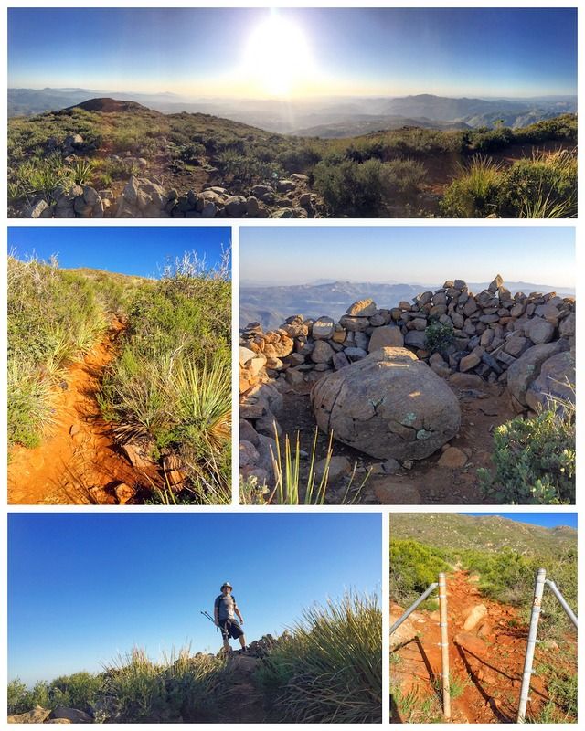
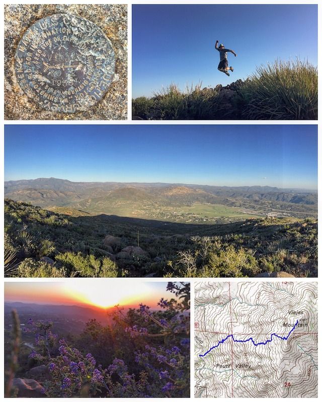
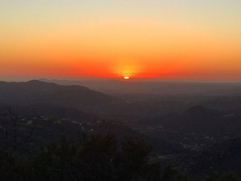
I love to sit on a mountain top and gaze. I don't think of anything but the people I care about and the view.
This mountain is a sacred mountain to the Kumeyaay Indians who made a pilgrimage to the summit to watch the sun rise over Buckman Peak for winter solstice. A marker made of rocks pointed 16 miles to the southeast to the 4641-foot peak and was used to help create a windbreak in the 1970s.
Flowers abound in the spring, including yucca and ceanothus, with hummingbirds and swallowtail butterflies that are delightful. Shrub oak, felt-leafed yerba santa, chamise, and manzanita blanket the mountain that is green again, ten years after the 2003 Cedar Fire scoured the mountain.
Starting at 2700 feet, the trail begins with a gentle slope and then starts to climb relentlessly at an average grade of 20 percent. Stop and look at the amazing views of San Diego County’s valleys and mountains as you climb. El Cajon Mountain in its vast granite glory will be behind you. As 3000 feet is reached, Palomar and San Jacinto mountains come into view with San Gorgonio Mountain visible at 3300 feet. The views just keep getting better as you climb.
At the 4187-foot summit, there is a rock wind shelter with a boulder in the center. Sit and enjoy the beauty of the granitic peaks of San Diego County before returning on the same trail. The hike is enjoyable all year long, but it can be very hot in the summer months, so start early. Look back along the trail climbing to the summit and know your comfort level for the return as the descent is on those same loose rocks, washouts, and slick areas. The chance of having the mountain to yourself is very high as this is a trail less traveled.
3 miles | +1500'
I love to sit on a mountain top and gaze. I don't think of anything but the people I care about and the view.
This mountain is a sacred mountain to the Kumeyaay Indians who made a pilgrimage to the summit to watch the sun rise over Buckman Peak for winter solstice. A marker made of rocks pointed 16 miles to the southeast to the 4641-foot peak and was used to help create a windbreak in the 1970s.
Flowers abound in the spring, including yucca and ceanothus, with hummingbirds and swallowtail butterflies that are delightful. Shrub oak, felt-leafed yerba santa, chamise, and manzanita blanket the mountain that is green again, ten years after the 2003 Cedar Fire scoured the mountain.
Starting at 2700 feet, the trail begins with a gentle slope and then starts to climb relentlessly at an average grade of 20 percent. Stop and look at the amazing views of San Diego County’s valleys and mountains as you climb. El Cajon Mountain in its vast granite glory will be behind you. As 3000 feet is reached, Palomar and San Jacinto mountains come into view with San Gorgonio Mountain visible at 3300 feet. The views just keep getting better as you climb.
At the 4187-foot summit, there is a rock wind shelter with a boulder in the center. Sit and enjoy the beauty of the granitic peaks of San Diego County before returning on the same trail. The hike is enjoyable all year long, but it can be very hot in the summer months, so start early. Look back along the trail climbing to the summit and know your comfort level for the return as the descent is on those same loose rocks, washouts, and slick areas. The chance of having the mountain to yourself is very high as this is a trail less traveled.
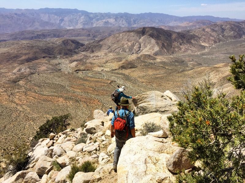
#20 Corte Madera Mountain
6.5 miles | +1800'
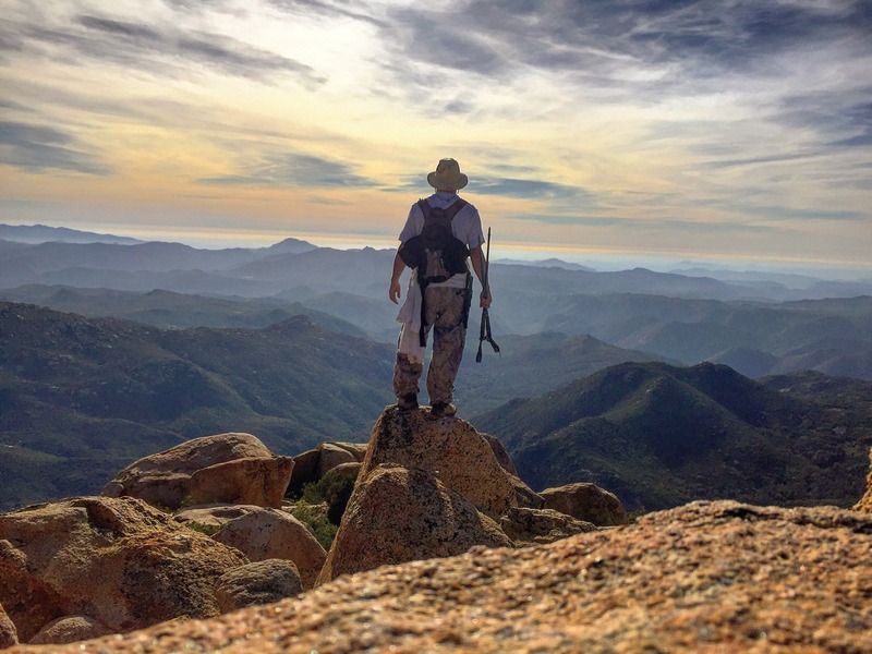
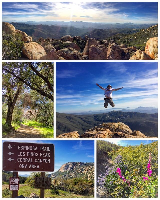
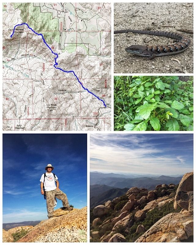
Known as San Diego's "Half Dome", the imposing face of Corte Madera Mounatin is quite impressive. Located in the Eastern portion of San Diego in the Cleveland National Forest, and at an elevation of 4,657 feet, it offers a great view of the surrounding backcountry. The trail traverses through a variety of terrain and beautiful areas on its way to the summit.
From the trail head along Corral Canyon Road, enjoy an oak-shaded dirt road for 0.5 mile and then continue in the northwest direction behind the signed garbage can onto the Espinosa Trail.
At 1.5 miles, look back over the view of the valley at the hiker’s gate before crossing the intersection of fire roads. This is the first view of the 300-foot-high precipice of Corte Madera Mountain just right and beyond the sign. Clearly marked are Espinosa Trail, Los Pinos Peak (closed vertical access road) and the Corral Canyon OHV Area. An added wooden sign labeled Corte Madera Mt. points to the right, where you continue on a fire road until coming to a T junction. Directly across and to the right of a slab of granodiorite rocks, another Birds of Prey sign marks the Corte Madera Mountain Trail. The trail narrows with manzanita, sage, rocks, Coulter pines, and oaks making it easy to follow but sometimes a challenge to see at a distance.
What has been a steady uphill becomes steep to near a 60 percent grade up and over the 4588-foot peak. This is where trekking poles and/or hands help scramble up and over rocks and loose soil. Take a break and bring your cameras out for spectacular views of Los Pinos Mt., Long Valley Peak, Corte Madera Valley, and the Pine Valley Bridge over Secret Canyon. Continue past the split rock and start down. Once descending past a huge boulder at your left shoulder, the last mile seems effortless. The trail is easy to follow with one Y junction where you veer left. The right leads up to private property in Corte Madera Valley. There are a couple of granodiorite slabs where cairns help your confidence in continuing on the trail to Corte Madera Mountain peak.
The 360-degree view of mountain ranges and valleys is remarkable on a clear day. To the south in Baja California is the Sierra Juarez plateau with the Santa Catalina and San Clemente islands to the west; east has a view of Los Pinos Mountain and the Espinosa Trail.
6.5 miles | +1800'
Known as San Diego's "Half Dome", the imposing face of Corte Madera Mounatin is quite impressive. Located in the Eastern portion of San Diego in the Cleveland National Forest, and at an elevation of 4,657 feet, it offers a great view of the surrounding backcountry. The trail traverses through a variety of terrain and beautiful areas on its way to the summit.
From the trail head along Corral Canyon Road, enjoy an oak-shaded dirt road for 0.5 mile and then continue in the northwest direction behind the signed garbage can onto the Espinosa Trail.
At 1.5 miles, look back over the view of the valley at the hiker’s gate before crossing the intersection of fire roads. This is the first view of the 300-foot-high precipice of Corte Madera Mountain just right and beyond the sign. Clearly marked are Espinosa Trail, Los Pinos Peak (closed vertical access road) and the Corral Canyon OHV Area. An added wooden sign labeled Corte Madera Mt. points to the right, where you continue on a fire road until coming to a T junction. Directly across and to the right of a slab of granodiorite rocks, another Birds of Prey sign marks the Corte Madera Mountain Trail. The trail narrows with manzanita, sage, rocks, Coulter pines, and oaks making it easy to follow but sometimes a challenge to see at a distance.
What has been a steady uphill becomes steep to near a 60 percent grade up and over the 4588-foot peak. This is where trekking poles and/or hands help scramble up and over rocks and loose soil. Take a break and bring your cameras out for spectacular views of Los Pinos Mt., Long Valley Peak, Corte Madera Valley, and the Pine Valley Bridge over Secret Canyon. Continue past the split rock and start down. Once descending past a huge boulder at your left shoulder, the last mile seems effortless. The trail is easy to follow with one Y junction where you veer left. The right leads up to private property in Corte Madera Valley. There are a couple of granodiorite slabs where cairns help your confidence in continuing on the trail to Corte Madera Mountain peak.
The 360-degree view of mountain ranges and valleys is remarkable on a clear day. To the south in Baja California is the Sierra Juarez plateau with the Santa Catalina and San Clemente islands to the west; east has a view of Los Pinos Mountain and the Espinosa Trail.
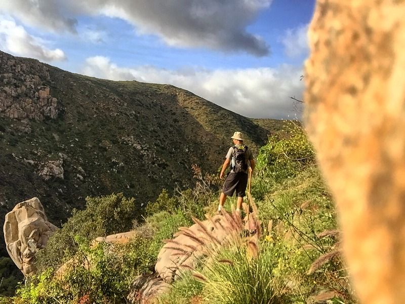
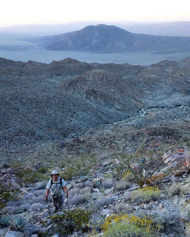
#21 Grapevine Mountain
6.25 miles | +2100'
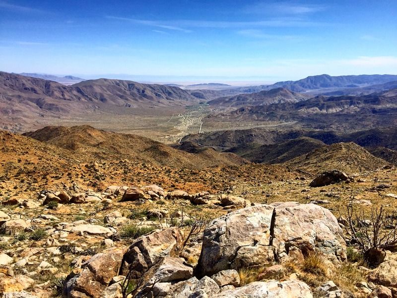
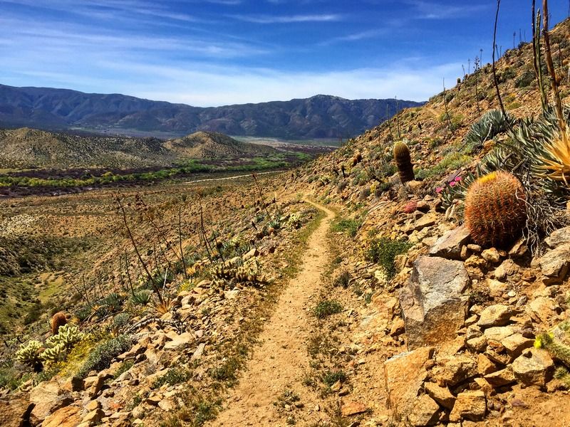
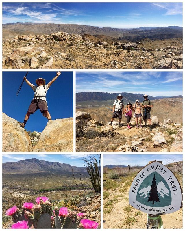
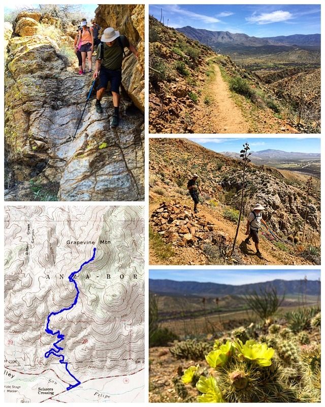
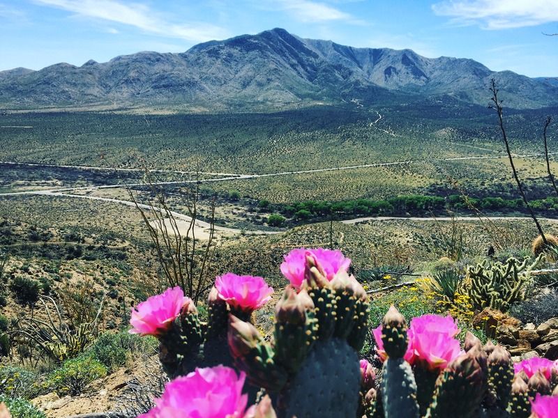
Grapevine Mountain is a prominent mountain located in northeastern San Diego County about 12 miles east of Julian in the Anza Borrego Desert.
The hike from the trailhead takes you along a cactus-strewn section of the PCT. Making the summit will require a little route-finding skill and a lot of off trail travel, including some light class 3 and 4 rock scrambling and bushwhacking through fields of cactus and thorny things. Notable sights from the summit include views of Mt. San Jacinto, the Superstition Mountains, Granite Peak, and Cuyamaca Peak.
We took an alternate route to the one described in Jerry Schad’s Afoot & Afield in San Diego County. Parking for the trailhead on our hike can be found on the northwest corner of HWY 78 and San Felipe Road.
The 2600-mile Pacific Crest Trail (PCT), which was intended to hit as many high points as possible along its mountainous route between the Mexican and Canadian borders, takes an anomalous detour into the Anza-Borrego Desert within San Diego County. At the time this segment of the PCT was built (1980s), a shorter, high-elevation route following the forested Volcan Mountain crest to the west was unavailable due to a large parcel of private property in the way. As a result, the PCT was circuitously routed down from the Laguna Mountain crest to Scissors Crossing, then up and over the dry San Felipe Hills toward Warner Springs. The excessively winding, 24-mile stretch between Scissors Crossing and Highway S-22, featuring no water, furnace-like heat at times, and only marginal camping spots, challenges the patience of anyone who tries to follow it all the way — including the Mexico-to-Canada “through-hikers,” who typically travel this section in April.
For those with an interest in botany, however, the San Felipe stretch of the PCT — at least the initial couple of miles upward from Scissors Crossing — is rewarding, especially after winter rains bring sufficient moisture to the desert.
6.25 miles | +2100'
Grapevine Mountain is a prominent mountain located in northeastern San Diego County about 12 miles east of Julian in the Anza Borrego Desert.
The hike from the trailhead takes you along a cactus-strewn section of the PCT. Making the summit will require a little route-finding skill and a lot of off trail travel, including some light class 3 and 4 rock scrambling and bushwhacking through fields of cactus and thorny things. Notable sights from the summit include views of Mt. San Jacinto, the Superstition Mountains, Granite Peak, and Cuyamaca Peak.
We took an alternate route to the one described in Jerry Schad’s Afoot & Afield in San Diego County. Parking for the trailhead on our hike can be found on the northwest corner of HWY 78 and San Felipe Road.
The 2600-mile Pacific Crest Trail (PCT), which was intended to hit as many high points as possible along its mountainous route between the Mexican and Canadian borders, takes an anomalous detour into the Anza-Borrego Desert within San Diego County. At the time this segment of the PCT was built (1980s), a shorter, high-elevation route following the forested Volcan Mountain crest to the west was unavailable due to a large parcel of private property in the way. As a result, the PCT was circuitously routed down from the Laguna Mountain crest to Scissors Crossing, then up and over the dry San Felipe Hills toward Warner Springs. The excessively winding, 24-mile stretch between Scissors Crossing and Highway S-22, featuring no water, furnace-like heat at times, and only marginal camping spots, challenges the patience of anyone who tries to follow it all the way — including the Mexico-to-Canada “through-hikers,” who typically travel this section in April.
For those with an interest in botany, however, the San Felipe stretch of the PCT — at least the initial couple of miles upward from Scissors Crossing — is rewarding, especially after winter rains bring sufficient moisture to the desert.
#22 South Fortuna Mountain
4.5 miles | +1400'
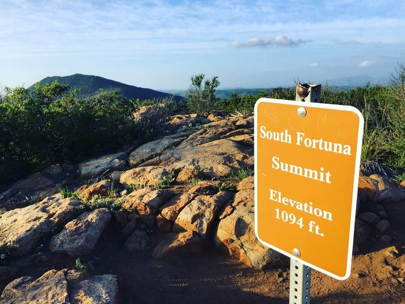
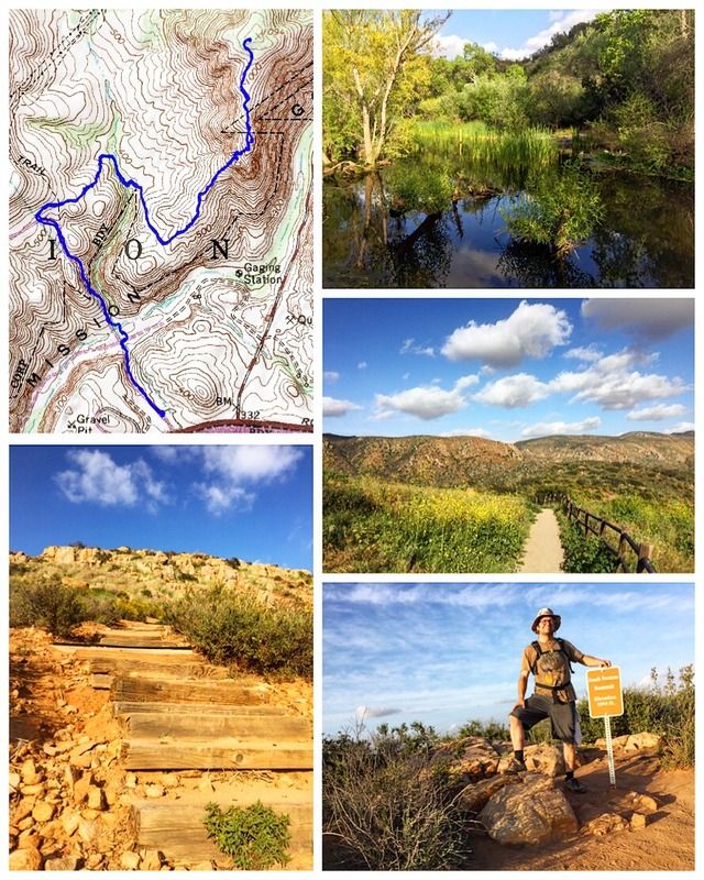
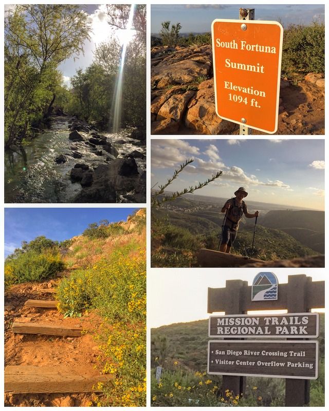
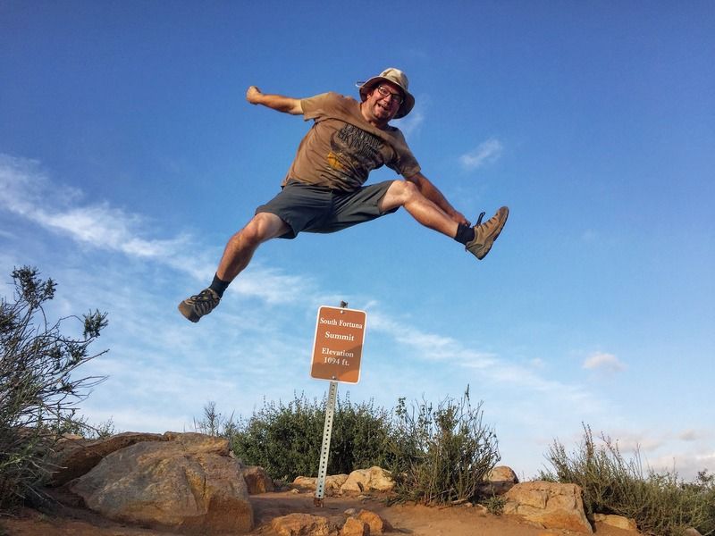
The top of 1094-foot South Fortuna Mountain has sweeping views of all of the major peaks found in the City of San Diego’s largest regional park. South Fortuna is part of a long arced mountain with two peaks that was once called on century-old maps Long Mountain. North Fortuna, at 1291 feet, is separated from South Fortuna by a 910-foot saddle. This long mountain provided physical fitness training for U.S. Marines when Camp Elliott was active. It is still a great place for a workout with many possible approaches and loops possible.
Although not the tallest of the two peaks, South Fortuna has one of the best views and is the most challenging when approached from the south ridge. Instead of switchback that would make the climb easier, there is a steep staircase of about 300 steps fashioned from 4x6-foot timbers and rock leading up to the bench from which there is an easy stroll to the summit.
4.5 miles | +1400'
The top of 1094-foot South Fortuna Mountain has sweeping views of all of the major peaks found in the City of San Diego’s largest regional park. South Fortuna is part of a long arced mountain with two peaks that was once called on century-old maps Long Mountain. North Fortuna, at 1291 feet, is separated from South Fortuna by a 910-foot saddle. This long mountain provided physical fitness training for U.S. Marines when Camp Elliott was active. It is still a great place for a workout with many possible approaches and loops possible.
Although not the tallest of the two peaks, South Fortuna has one of the best views and is the most challenging when approached from the south ridge. Instead of switchback that would make the climb easier, there is a steep staircase of about 300 steps fashioned from 4x6-foot timbers and rock leading up to the bench from which there is an easy stroll to the summit.
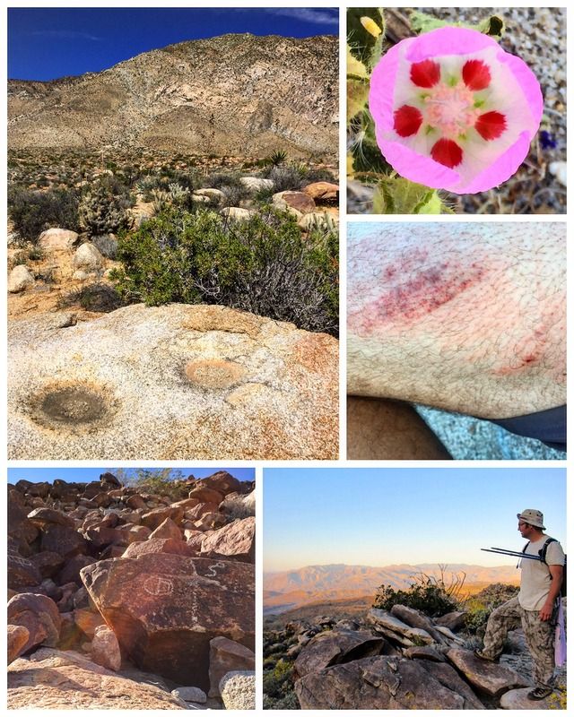
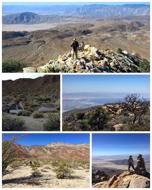
#23 & 24 Peak 6582 (Dawns Peak) Backpacking Trek
14 miles | +6200'
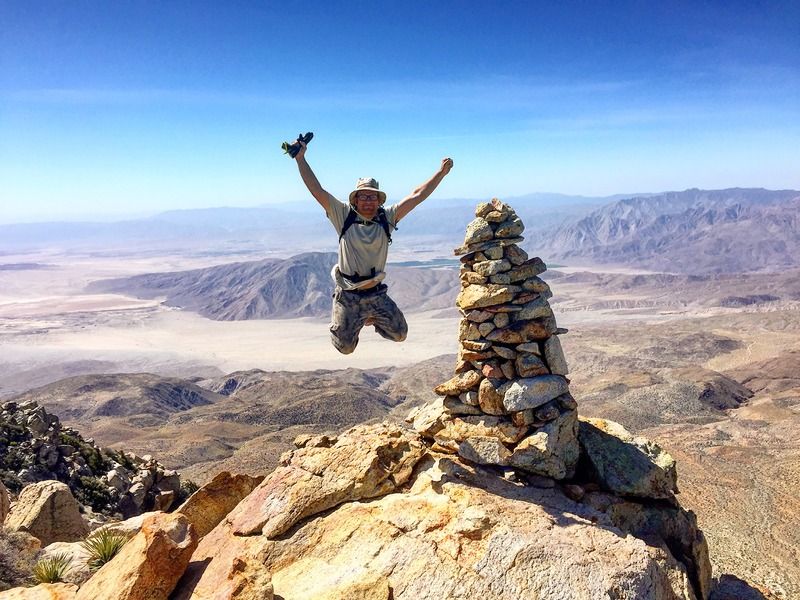
I can say without a doubt that this was the most difficult hike I've ever done. Words fail to describe the feelings of accomplishment and awe I experienced at the summit. My companions were Scott Turner (co-author of the 5th edition to Afoot & Afield in San Diego County), and Don Endicott, a former hiking companion of Jerry Schad.
Here is Don's write up:
Anza-Borrego Desert State Park and Santa Rosa Wilderness
Saturday, Sunday 26-27 March 2016
"One of the more strenuous hikes in the Anza-Borrego Desert State Park area, Dawn’s Peak is situated half way between Toro Peak and Rabbit Peak along the backbone of the Santa Rosa Mountains northeast of Borrego Springs, California and southwest of Palms Springs, Indio, and the Coachella Valley.
I previously hiked and mapped this entirely cross country route back in April 2007 during a two day backpack with good friend Don Raether. This year, I teamed with Scott Turner and his friend John Graham for a reprise of that hike and to help Scott complete the last hike of his year-long effort to co-author a new 5th Edition of Afoot & Afield in San Diego County, THE San Diego hiker’s bible, originally written by my good friend and hiking and running companion, Jerry Schad.
As was the case nine years ago, we packed in about four miles from upper Clark Valley to spend the night, passing the Corp benchmark and petroglyph site along the way. Based on experience, I carried 11 liters of water, adding a hefty 24 pounds to the rest of my pack, contributing to a relatively modest pace to scramble and rock hop through broken terrain to reach camp in a side canyon at 2400 feet, a 4 mile, 1600 foot ascent. After dinner and quiet conversation, Scott and John turned in and I stayed up a bit longer to take in the exceptional night sky, including the constellations Canis Major, Orion, and Taurus parading over the ridge to the southwest.
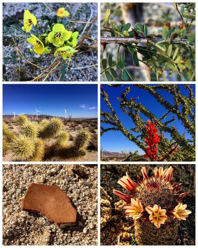
Next morning we arose early, packed our gear, donned daypacks, and started hiking in predawn twilight a little after 6 am. The first section is steep and rocky, ascending 1000 vertical feet to reach rolling bench that leads to the base of Dawn’s Peak. The wildflowers were exceptional with lush yellow Brittlebush seemingly everywhere. Brilliant magenta blossoms of Hedgehog Cactus and Beavertail Cactus accented our route as did a variety of smaller, ground level flowers.
The last mile to the summit follows the west ridge of Dawn’s Peak and involves a climb of 3000 vertical feet of slip-and-slide hiking along the backbone of decomposed granite and large boulder outcrops with agave and cholla obstacles on the lower half and Pinyon and agave on the upper half. As we topped out on the crest of the Santa Rosas, we met up with Robert Hunt, another accomplished desert hiker and ultra-distance runner. Robert had trekked in and up from Rockhouse Canyon by moonlight last night and celebrated Easter Sunrise in the summit area. Although knowing of each other, this was the first time we actually met Robert in person.
At the summit cairn, everyone took a turn signing into a peak register that went back to the early 1980s that included Jerry Schad’s log entry from February 1983. I left a copy of my celebration of life eulogy originally given at Jerry’s memorial service in November 2011. I noted that our hiking time up from camp was a decent 4 hours and 40 minutes, only 10 minutes longer than in 2007 – not bad for someone now old enough to qualify for Medicare.
Following lunch, Robert joined us for the hike out. Aside from a hefty rock that came tumbling down to just miss Scott and 40 feet below graze my pack as I hugged against an outcrop, our descent was uneventful. On the way back to camp, I pointed out a village site I had discovered back in 2007. We also passed a large agave roasting pit, along with pottery sherds and fragments of flake stone, further evidence of the many centuries of occupation by the native Mountain Cahuilla.
After picking up our packs, we followed our original trail in reverse, impressed with how far we had come and how much we had climbed. Along the way a partial olla was discovered, admired, photographed, and returned to its cubby hole. Back down at the Corp petroglyphs, we parted with Robert who still had five miles to reach his car at the Hidden Spring trailhead.
We arrived back at my 4Runner shortly before 7 pm with handshakes and congratulations to Scott for completing this capstone trip and finalizing the Afoot & Afield project."
Trip Summary
Total Distance: 14 miles round trip
Elevation Gain/Loss: 6200 feet
Hiking Time (Saturday, trailhead to overnight camp) – 3 hours
Hiking Time (Sunday, overnight camp to summit to trailhead) – 11 hours 20 min
14 miles | +6200'
I can say without a doubt that this was the most difficult hike I've ever done. Words fail to describe the feelings of accomplishment and awe I experienced at the summit. My companions were Scott Turner (co-author of the 5th edition to Afoot & Afield in San Diego County), and Don Endicott, a former hiking companion of Jerry Schad.
Here is Don's write up:
Anza-Borrego Desert State Park and Santa Rosa Wilderness
Saturday, Sunday 26-27 March 2016
"One of the more strenuous hikes in the Anza-Borrego Desert State Park area, Dawn’s Peak is situated half way between Toro Peak and Rabbit Peak along the backbone of the Santa Rosa Mountains northeast of Borrego Springs, California and southwest of Palms Springs, Indio, and the Coachella Valley.
I previously hiked and mapped this entirely cross country route back in April 2007 during a two day backpack with good friend Don Raether. This year, I teamed with Scott Turner and his friend John Graham for a reprise of that hike and to help Scott complete the last hike of his year-long effort to co-author a new 5th Edition of Afoot & Afield in San Diego County, THE San Diego hiker’s bible, originally written by my good friend and hiking and running companion, Jerry Schad.
As was the case nine years ago, we packed in about four miles from upper Clark Valley to spend the night, passing the Corp benchmark and petroglyph site along the way. Based on experience, I carried 11 liters of water, adding a hefty 24 pounds to the rest of my pack, contributing to a relatively modest pace to scramble and rock hop through broken terrain to reach camp in a side canyon at 2400 feet, a 4 mile, 1600 foot ascent. After dinner and quiet conversation, Scott and John turned in and I stayed up a bit longer to take in the exceptional night sky, including the constellations Canis Major, Orion, and Taurus parading over the ridge to the southwest.
Next morning we arose early, packed our gear, donned daypacks, and started hiking in predawn twilight a little after 6 am. The first section is steep and rocky, ascending 1000 vertical feet to reach rolling bench that leads to the base of Dawn’s Peak. The wildflowers were exceptional with lush yellow Brittlebush seemingly everywhere. Brilliant magenta blossoms of Hedgehog Cactus and Beavertail Cactus accented our route as did a variety of smaller, ground level flowers.
The last mile to the summit follows the west ridge of Dawn’s Peak and involves a climb of 3000 vertical feet of slip-and-slide hiking along the backbone of decomposed granite and large boulder outcrops with agave and cholla obstacles on the lower half and Pinyon and agave on the upper half. As we topped out on the crest of the Santa Rosas, we met up with Robert Hunt, another accomplished desert hiker and ultra-distance runner. Robert had trekked in and up from Rockhouse Canyon by moonlight last night and celebrated Easter Sunrise in the summit area. Although knowing of each other, this was the first time we actually met Robert in person.
At the summit cairn, everyone took a turn signing into a peak register that went back to the early 1980s that included Jerry Schad’s log entry from February 1983. I left a copy of my celebration of life eulogy originally given at Jerry’s memorial service in November 2011. I noted that our hiking time up from camp was a decent 4 hours and 40 minutes, only 10 minutes longer than in 2007 – not bad for someone now old enough to qualify for Medicare.
Following lunch, Robert joined us for the hike out. Aside from a hefty rock that came tumbling down to just miss Scott and 40 feet below graze my pack as I hugged against an outcrop, our descent was uneventful. On the way back to camp, I pointed out a village site I had discovered back in 2007. We also passed a large agave roasting pit, along with pottery sherds and fragments of flake stone, further evidence of the many centuries of occupation by the native Mountain Cahuilla.
After picking up our packs, we followed our original trail in reverse, impressed with how far we had come and how much we had climbed. Along the way a partial olla was discovered, admired, photographed, and returned to its cubby hole. Back down at the Corp petroglyphs, we parted with Robert who still had five miles to reach his car at the Hidden Spring trailhead.
We arrived back at my 4Runner shortly before 7 pm with handshakes and congratulations to Scott for completing this capstone trip and finalizing the Afoot & Afield project."
Trip Summary
Total Distance: 14 miles round trip
Elevation Gain/Loss: 6200 feet
Hiking Time (Saturday, trailhead to overnight camp) – 3 hours
Hiking Time (Sunday, overnight camp to summit to trailhead) – 11 hours 20 min
Last edited:
#25 PCT: Boulder Oaks to Buckman Springs
5.25 miles | +200'
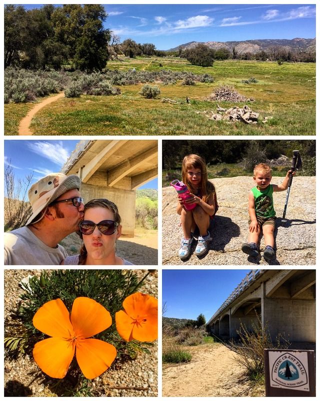
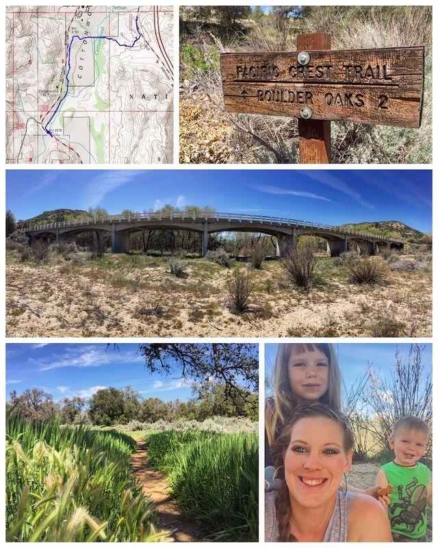
Stretching from Mexico to Canada, the 2,650 mile PCT is traversed by more than 350 thru-hikers annually. In addition, thousands of day hikers drop on and off the famed trail, officially designated by Congress on October 2, 1968.
As a native San Diegan, I've been so pleased to find the stunning beauty of the Pacific Crest Trail practically in my own backyard.
This hike is generally made only by PCT thru-hikers those on their way north towards the Laguna Mountains from Lake Morena. From Old Highway 80, the flat trail enters Boulder Oaks Campground, which has horse corrals and 30 campsites. The trail narrows leaving the campground and skirts large outcroppings of gray boulders, atypical of the red rock formations usually found in the Laguna Mountains. Nearly half of this hike parallels Buckman Springs Road, so the sounds of passing cars often intrudes on the solitude and tranquility. A meadow of live oaks provides welcome shade on sunny days. This section of the PCT ends just below a white bridge spanning over Cottonwood Creek at Buckman Springs Road. From here, the trail continues uphill towards Lake Morena.
5.25 miles | +200'
Stretching from Mexico to Canada, the 2,650 mile PCT is traversed by more than 350 thru-hikers annually. In addition, thousands of day hikers drop on and off the famed trail, officially designated by Congress on October 2, 1968.
As a native San Diegan, I've been so pleased to find the stunning beauty of the Pacific Crest Trail practically in my own backyard.
This hike is generally made only by PCT thru-hikers those on their way north towards the Laguna Mountains from Lake Morena. From Old Highway 80, the flat trail enters Boulder Oaks Campground, which has horse corrals and 30 campsites. The trail narrows leaving the campground and skirts large outcroppings of gray boulders, atypical of the red rock formations usually found in the Laguna Mountains. Nearly half of this hike parallels Buckman Springs Road, so the sounds of passing cars often intrudes on the solitude and tranquility. A meadow of live oaks provides welcome shade on sunny days. This section of the PCT ends just below a white bridge spanning over Cottonwood Creek at Buckman Springs Road. From here, the trail continues uphill towards Lake Morena.
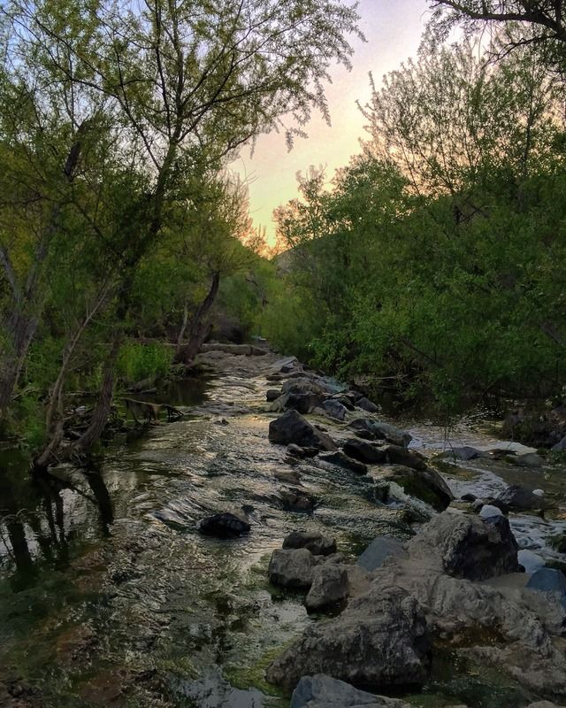
#26 Sweetwater River Loop
8 miles | +1000'
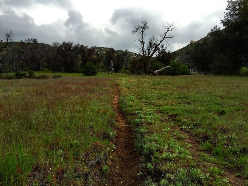

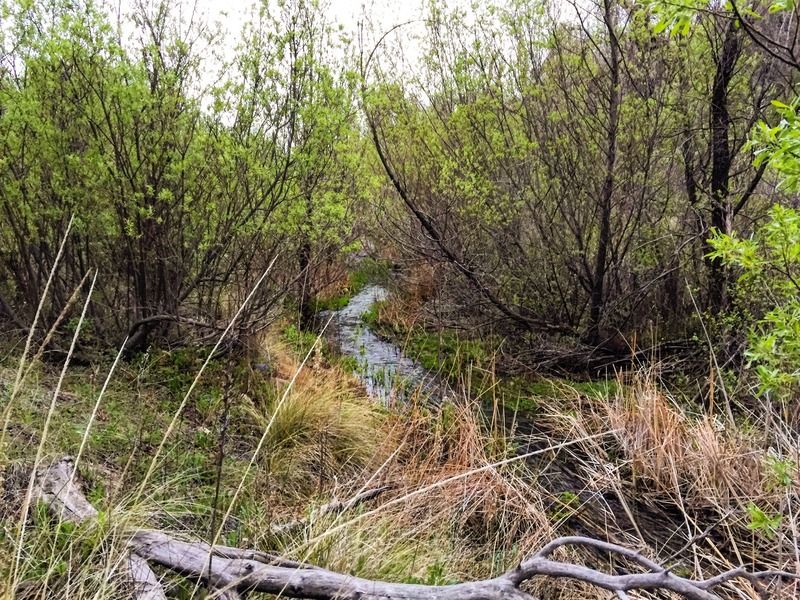
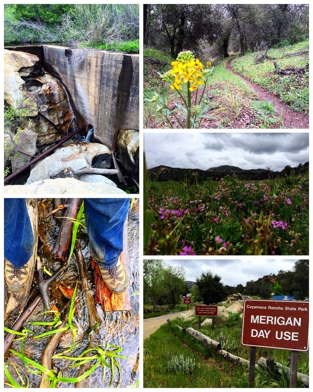
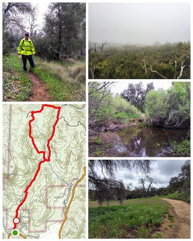
The Sweetwater River Loop at the base of the Cuyamaca Mountains is a great local hike. It's a very scenic route with a variety of terrain. Water crossings, steep climbs, oak shaded gullies, thick brush and poison oak to avoid, meadows, waterfalls and old diversion dams that beckon further exploration... and all in the rain and fog for me on this trip!
The Sweetwater River is a 55-mile long stream in San Diego County, California.
From its headwaters high in the Cuyamaca Mountains, the river flows generally southwest, first through rugged hinterlands but then into the urban areas surrounding its mouth at San Diego Bay. Its drainage basin covers more than 230 square miles, all of it within San Diego County. Towns on the river include Descanso, La Presa and Chula Vista.
The term "Sweetwater" is a name often given to freshwater which tastes good in regions where much of the water is bitter to the taste. The Spanish called the river "Agua Dulce", a name they applied to good clear water anywhere they lived.
8 miles | +1000'
The Sweetwater River Loop at the base of the Cuyamaca Mountains is a great local hike. It's a very scenic route with a variety of terrain. Water crossings, steep climbs, oak shaded gullies, thick brush and poison oak to avoid, meadows, waterfalls and old diversion dams that beckon further exploration... and all in the rain and fog for me on this trip!
The Sweetwater River is a 55-mile long stream in San Diego County, California.
From its headwaters high in the Cuyamaca Mountains, the river flows generally southwest, first through rugged hinterlands but then into the urban areas surrounding its mouth at San Diego Bay. Its drainage basin covers more than 230 square miles, all of it within San Diego County. Towns on the river include Descanso, La Presa and Chula Vista.
The term "Sweetwater" is a name often given to freshwater which tastes good in regions where much of the water is bitter to the taste. The Spanish called the river "Agua Dulce", a name they applied to good clear water anywhere they lived.
#9 Devil's Canyon & Myer Creek
14 miles | +1300'
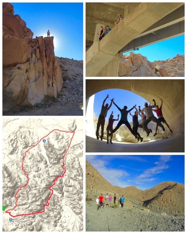
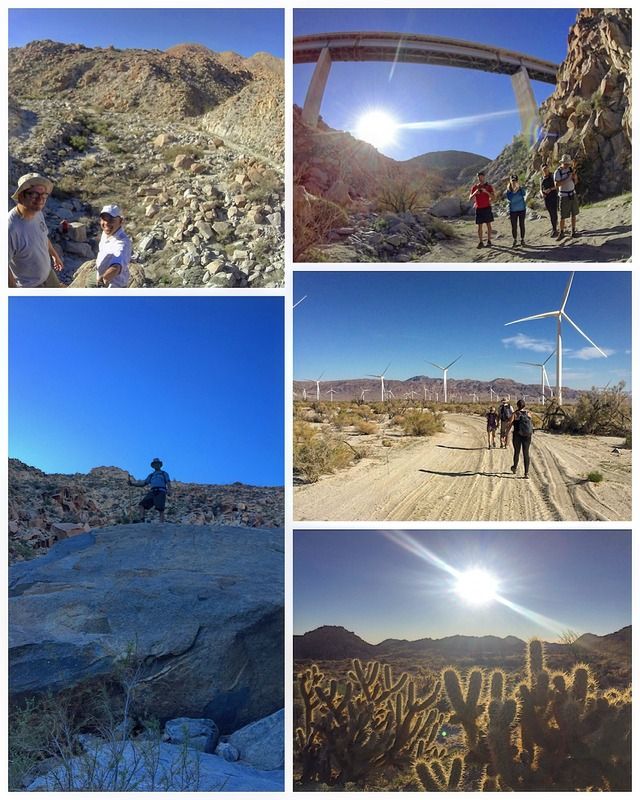
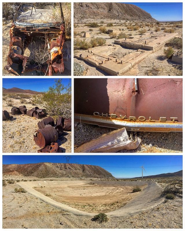
Devils Canyon runs from Mountain Springs, off Interstate 8, to Ocotillo just East of the San Diego/Imperial County line. It was a transportation route for freight and wagons heading west. The trail was opened in the 1860's as a toll road. With the construction of Old US 80 in 1910 and then I-8 in the 1960's, the old route was forgotten.
In 1976 a massive tropical storm washed out the canyon bottom, as well at the area's surrounding infrastructure. It was the most powerful tropical cylone ever to hit San Diego and Imperial Counties. With winds up to 90 miles an hour, Hurricane Kathleen dropped a foot of water on Mt. Laguna and sent a wall of water 10 feet high through the town of Ocotillo in neighboring Imperial Valley, destroying most of the town.
The powerful storm killed 13 people in California and Mexico. It also washed out sections of Interstate 8, and destroyed a bridge at Meyer Creek, leaving a gully in its place some 35 to 40 feet deep.
Devils Canyon was "rediscovered" in the early 2000's by local off-highway enthusiast and the route was made passable again by 4WD vehicles for a time before it was unfortunately closed down by the BLM. After a finding of "no signifigant impact", access to the canyon was again allowed but only via a special use permit.
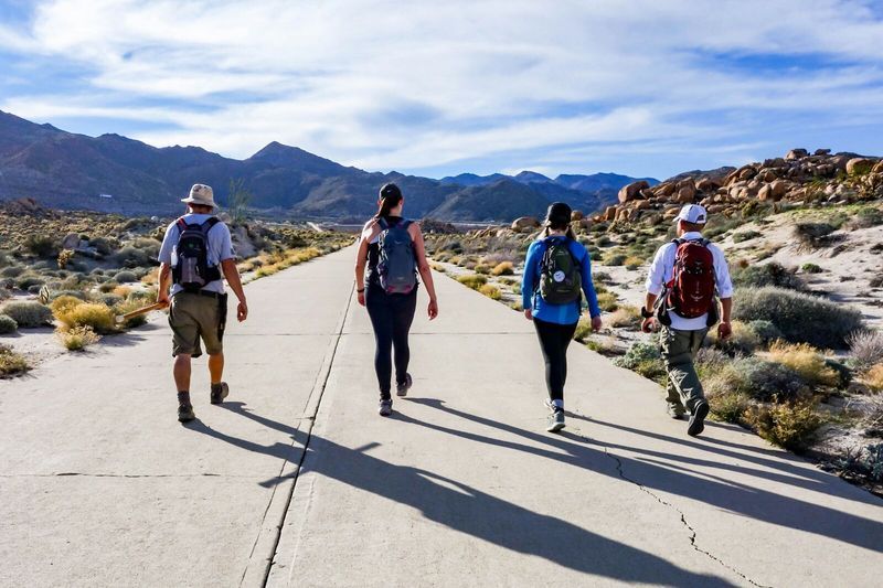
I think our hiking buddy, Robb said it best- "Mouths parched. Skin beaten, scratched, and sunburnt. Muscles aching and shoes full of coarse desert sand. They hike, not because they want to, but because they have to. Exploration is in their blood. It's what they do. It's who they are."
#9 Devil's Canyon & Myer Creek
14 miles | +1300'
Devils Canyon runs from Mountain Springs, off Interstate 8, to Ocotillo just East of the San Diego/Imperial County line. It was a transportation route for freight and wagons heading west. The trail was opened in the 1860's as a toll road. With the construction of Old US 80 in 1910 and then I-8 in the 1960's, the old route was forgotten.
In 1976 a massive tropical storm washed out the canyon bottom, as well at the area's surrounding infrastructure. It was the most powerful tropical cylone ever to hit San Diego and Imperial Counties. With winds up to 90 miles an hour, Hurricane Kathleen dropped a foot of water on Mt. Laguna and sent a wall of water 10 feet high through the town of Ocotillo in neighboring Imperial Valley, destroying most of the town.
The powerful storm killed 13 people in California and Mexico. It also washed out sections of Interstate 8, and destroyed a bridge at Meyer Creek, leaving a gully in its place some 35 to 40 feet deep.
Devils Canyon was "rediscovered" in the early 2000's by local off-highway enthusiast and the route was made passable again by 4WD vehicles for a time before it was unfortunately closed down by the BLM. After a finding of "no signifigant impact", access to the canyon was again allowed but only via a special use permit.
I think our hiking buddy, Robb said it best- "Mouths parched. Skin beaten, scratched, and sunburnt. Muscles aching and shoes full of coarse desert sand. They hike, not because they want to, but because they have to. Exploration is in their blood. It's what they do. It's who they are."
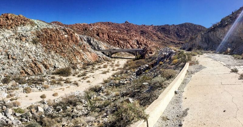
Hey John!
Is the bridge in the (2nd to the last photo) the old Sheep Canyon bridge? My understanding is that it was demolished in 1976 after the great storm. Is this bridge still being used by vehicles or has it been abandoned?
Thanks!
Mark